
Heritage and anomaly detection a building's condition surveyed by drone
For heritage architects, project owners and local authorities: before the works, I survey the building by drone and from the ground. You see every façade and every roof, and every defect found on the photos, in its place on the building.
The defects of a collegiate church, placed in 3D
114 defects found on the photos, 25 of them taken from the inspection report, each in the colour of its category; 33 call for a close-range investigation. Run the detection, then click a frame to open the photo that shows it.
Real anonymised data, shown for illustration.
Why survey a building by drone?
The drone photographs every face of the building, roofs included, from a safe distance. On the collegiate church shown here, it flew 19 to 42 m from the walls, and each pixel covers 5 to 11 mm of masonry.
An automatic analysis finds the defects on the photos. I check each detection at full resolution before placing it on the 3D model.
I recommend the full scan: the drone flies as close as possible to the structure and records the whole building at maximum resolution, in a single site visit. The preliminary-diagnosis scan flies further from the walls. The architect or engineering firm in charge of the project then decides what comes next: a full scan, a partial scan of certain areas at full resolution, rope-access work, and so on.

Inside, water and cracks
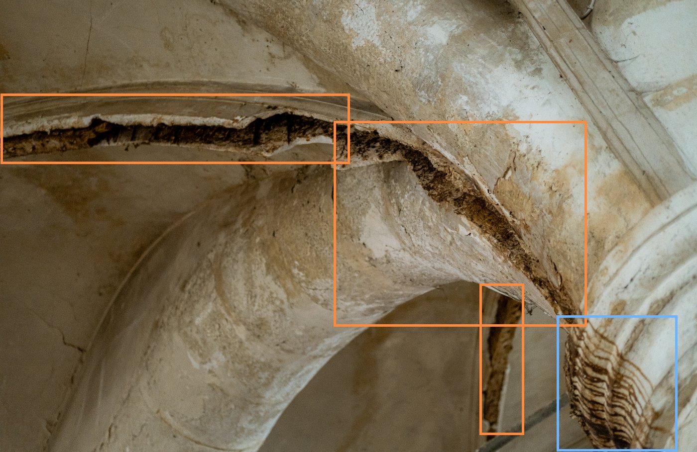
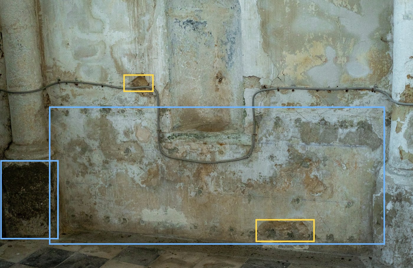
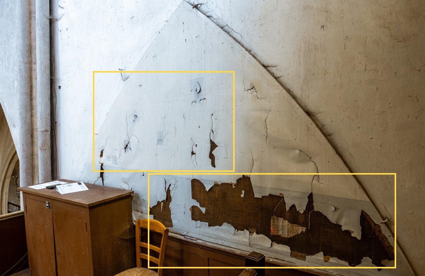
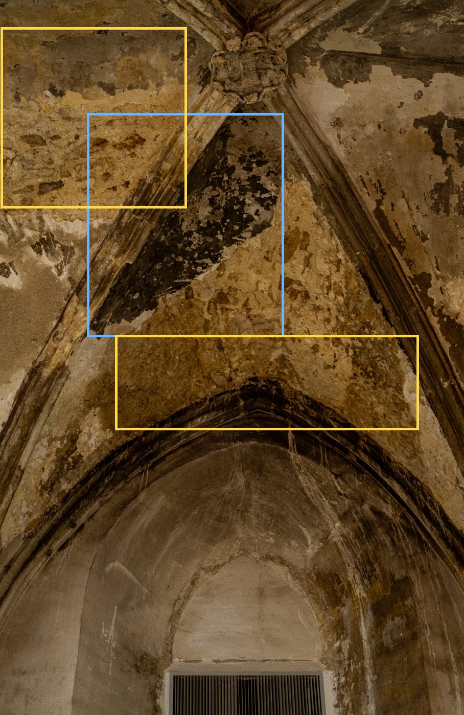
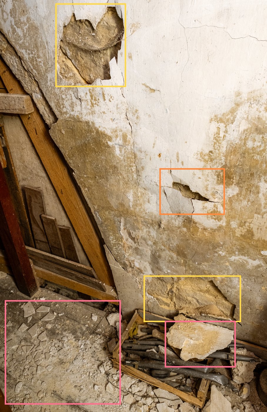
In another church, I photograph the interior from the ground as 360° panoramas, then record the defects as on the collegiate church: 113 defects that are clear at full resolution, from four viewpoints. Look around and click a frame to open its photo.
Other defects recorded inside
- Cracks and open joints
- Damp and water ingress
- Flaking plaster and paint
- Fallen material
From flight to report
-
01
Preparation
We agree together on the faces to survey, the access and the constraints of the site. I prepare the flight plan and the formalities; on sensitive or regulated sites, I work under protocol.
-
02
The survey flight
The drone photographs the whole building from a safe distance. From the ground, I photograph the interior and the details, in HDR in dark spaces.
-
03
The analysis, automatic and supervised
An AI finds the defects on the photos. I check each detection at full resolution and set aside the normal features of the building: ventilation tiles, putlog holes, lightning conductor cable.
-
04
The report
You receive the defects sorted by category, each with its photo, its location and its level of confidence, and the list of those that need a close-range investigation.
What you receive
An online space for the building
The 3D model, the defects and their photos, the orthophotos: you view everything in the browser, in a private space protected by an access code, with no software to install.
The diagnosis report
Sorted defects, located photos, level of confidence and investigation priorities, as PDF for the architect and the project owner.
Orthophotos and 3D model
True-scale façades and roofs as JPEG or TIFF; 3D model as OBJ, Collada, 3D PDF or for Google Earth.
Frequently asked questions
Can a drone fly close to a monument?
Yes, within European Regulation (EU) 2019/947: depending on the site, in the open category or in the specific category, the operator then being declared to the DGAC (French civil aviation authority). On sensitive or regulated sites, the work is carried out under protocol.
How detailed are the façades?
The level of detail depends on the drone's distance from the building during the flight. As a rule, it is finer than 5 mm per pixel. You can spot a missing slate, an open crack or a damaged joint, and measure directly on the image.
Does this survey replace a diagnosis?
This survey serves as a diagnosis before any decision: it locates and sorts the visible defects. The architect or the engineering firm assesses them and decides on the works; a close-range investigation checks those that need it.
How do you avoid false alarms from the automatic analysis?
I review each detection on its photo, at full resolution. On the collegiate church, I set aside more than forty: ventilation tiles, putlog holes, a lightning conductor cable, shadows and joints taken for cracks.
Do you survey the interior too?
Yes. I photograph the interior from the ground, in HDR to keep detail in dark vaults as well as near the stained glass, and I record the defects the same way.
A building to survey before the works?
Let's talk about your building, or take another look at the 3D demo of the collegiate church.
Olivier Lattuga, trained in photography and then a graduate of the EHESS, has spent fifteen years working with technical imagery and land. Based in Lyon, he works throughout France.
UAS operator declared to the DGAC (French civil aviation authority) — European standard scenario STS-01 (Regulation (EU) 2019/947) — flights under protocol on sensitive and regulated sites.