
Quarries volumes, operations monitoring and restoration by drone
For quarry, sand pit and gravel pit operators: I measure by drone the volume of your stockpiles, the volume extracted between two surveys, haul road gradients, the bed of water bodies and the progress of restoration, at the frequency you set.
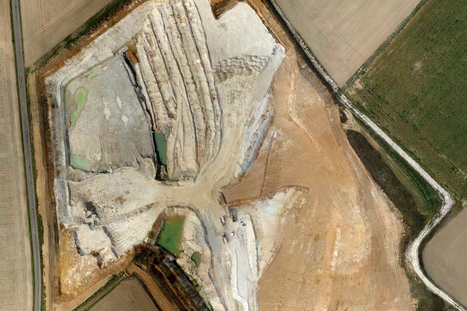
Why survey a quarry by drone?
One flight covers the whole site, stockpiles, faces, haul roads and water bodies included, and measures millions of points. Each volume follows the real shape of the ground instead of extrapolating between a few profiles.
The RTK drone and check points measured with an RTK GNSS receiver on a tripod tie each survey to within a few centimetres. Two successive surveys line up: the difference between them gives the volume extracted, backfilled or moved over the period.
You find every survey in a private online space, with no software to install. Your land surveyor, or a partner surveyor, signs off the plans and data.
What I measure, from stockpile to restoration
- Stockpile inventoryvolume and tonnage of each pile on the survey date, for the year-end inventory or a check during the year
- Operations monitoringvolume extracted between two surveys, progress of the faces and the pit floor
- Haul road gradientslongitudinal gradient, profile by profile, and sections above the threshold you set
- Bathymetrydepth and volume of water bodies, joined to the ground of the banks
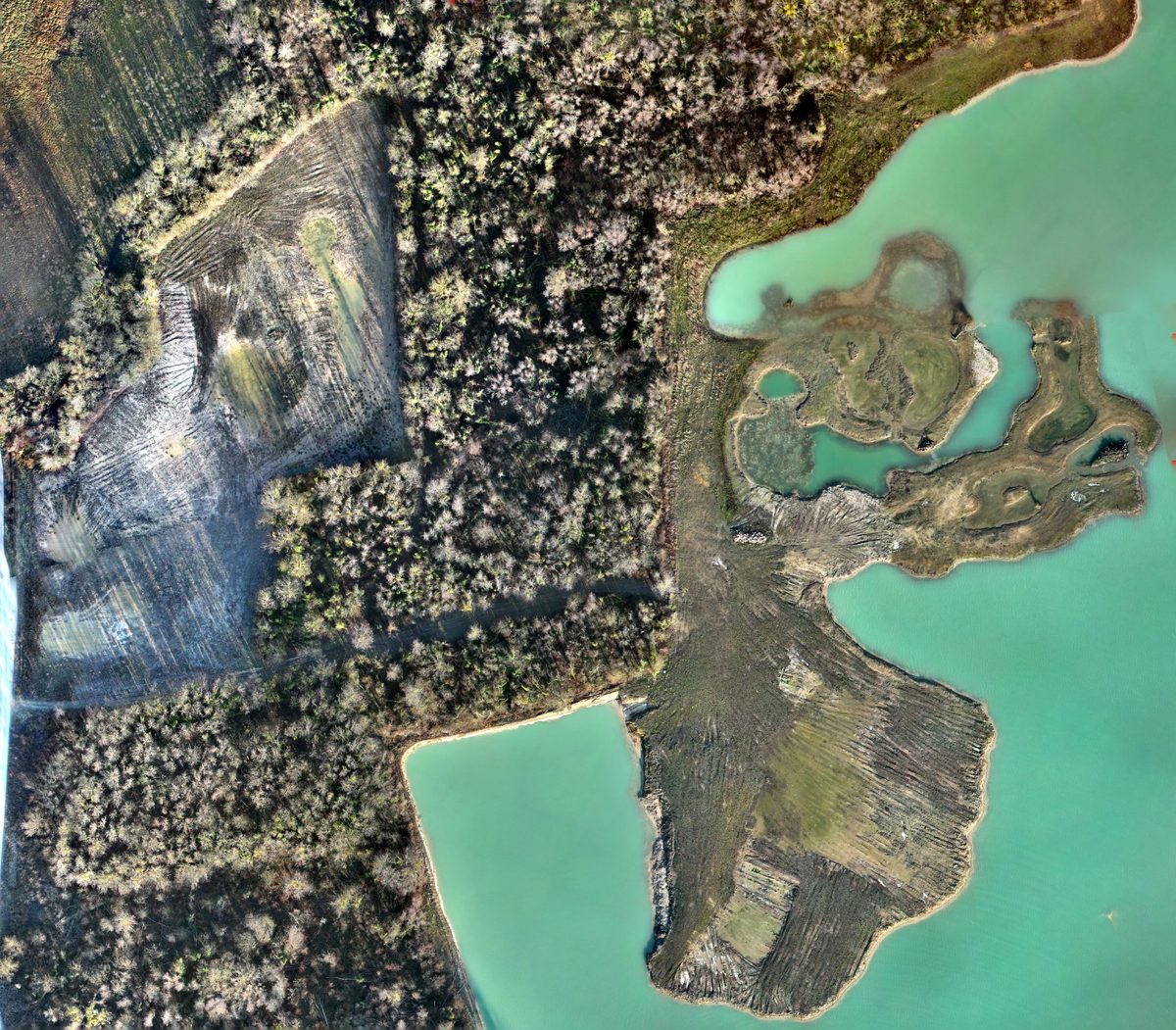
- Restorationrestored areas, banks, islands and shallows, survey after survey
- Financial guaranteesareas required by the file (S1, S2, restored land, banks) drawn and measured on the survey
Real quarries, in the demos
Each example comes from a real, anonymised survey: no coordinates, no place names, relative elevations. On the home page, the interactive demos let you take the measurements yourself.
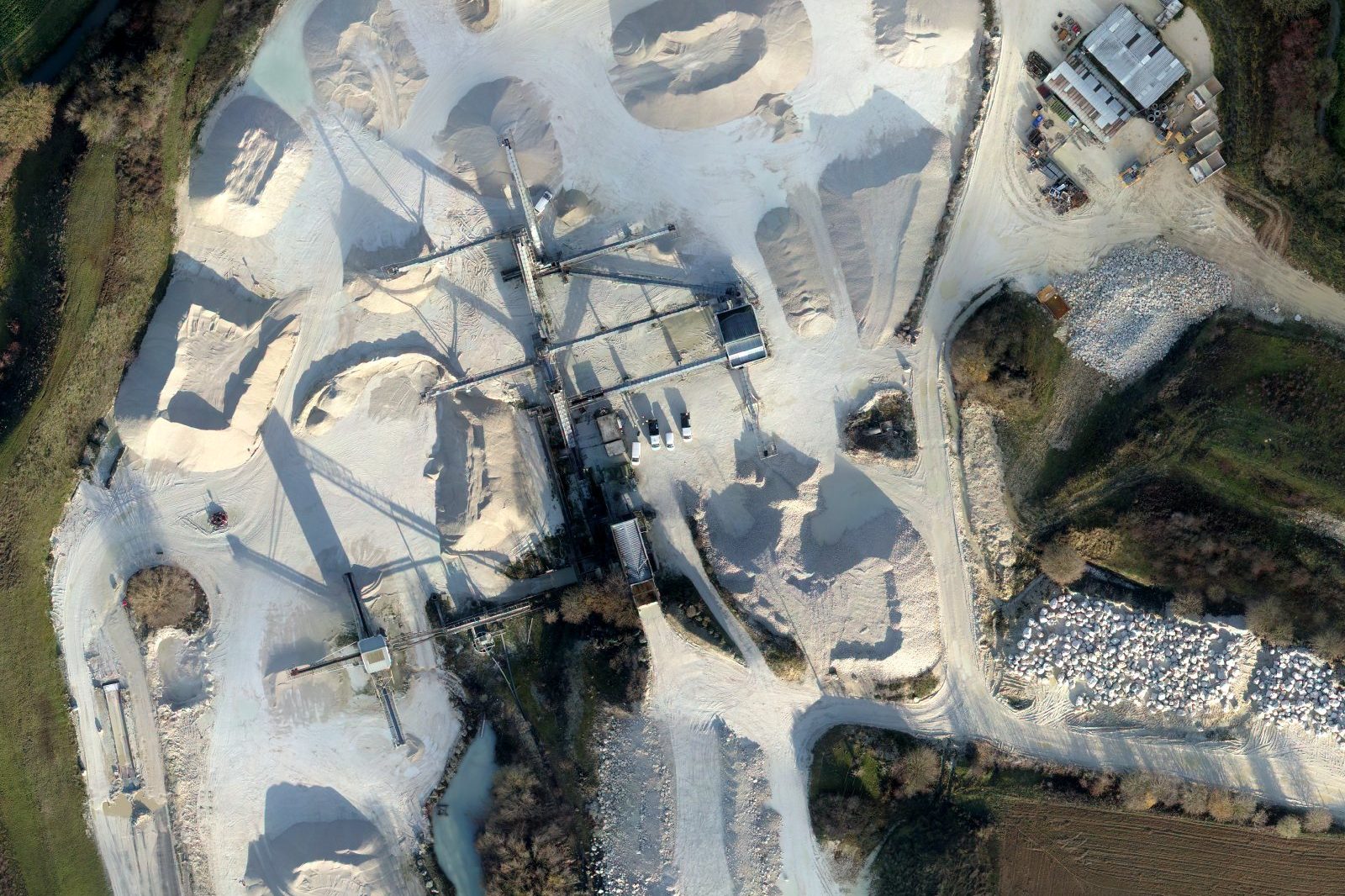
The stockpile inventory
- Piles measured
- 20
- Products
- 9
- Total volume
- 36,415 m³
- Tonnage
- 57,925 t
I outline each pile on the survey and measure its volume on the elevation model. With the density of each product, which you give me, the volume becomes a tonnage, pile by pile and in total.
You receive the stock table as PDF and CSV, one sheet per pile and an overview map.
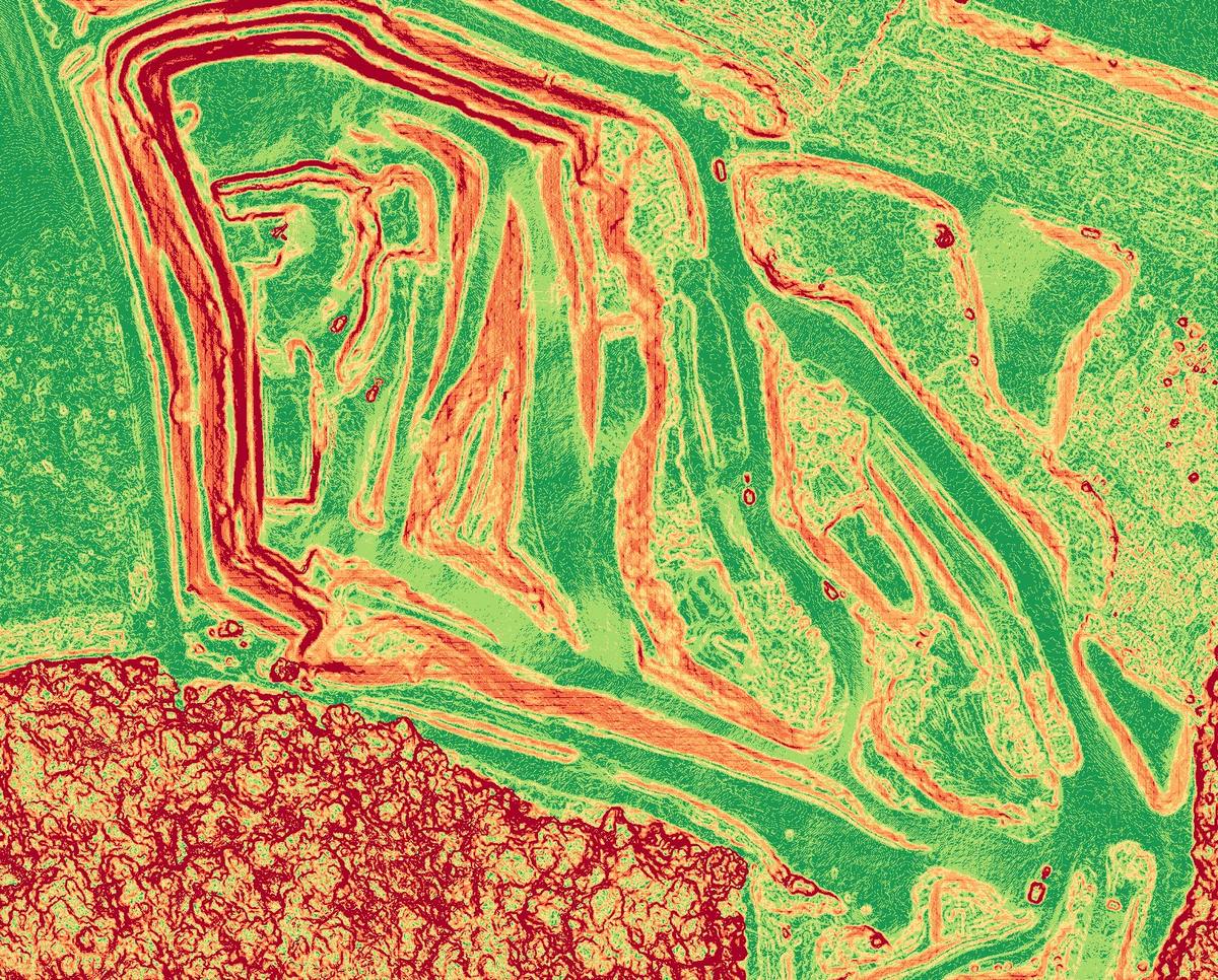
Haul road gradients
The slope map shows faces, banks, benches and haul roads across the whole quarry. For haul roads, I measure the longitudinal gradient, profile by profile, and flag the sections above the threshold you set.
In the online space, you draw a profile between two points yourself to read elevations and gradients.
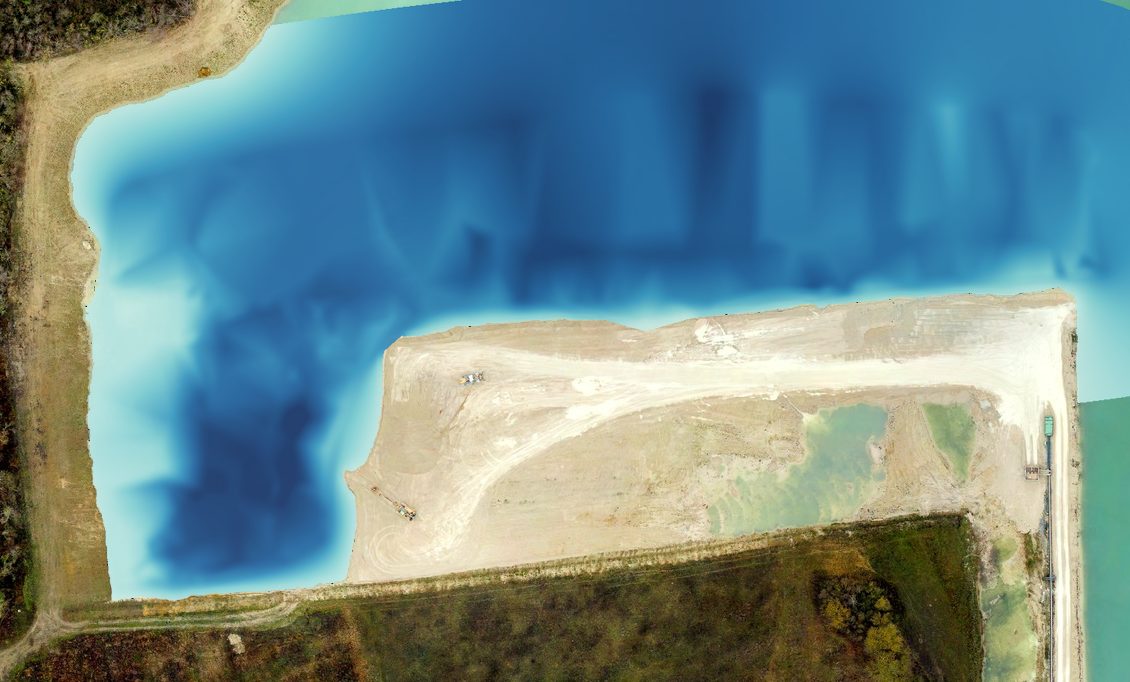
The bed of water bodies
Soundings taken on the water and tied to the drone survey give the modelled bed, its depth contours and the water volume. The bed joins the ground of the banks measured by the drone: one model, above and below the water.
You track wet extraction and plan the profile of the banks to restore.
Restoration and financial guarantees
I overlay the restoration plan on the orthophoto of the survey: you see whether the works follow the plan, and where the worked, restored and guaranteed areas stand.
I draw and measure the areas of your financial-guarantee file (S1, S2, restored land, banks), with the land registry, on a map from A0 to A4. Your land surveyor, or a partner surveyor, signs it off.
Surveys at the frequency you set
Every month to follow production, every quarter to reconcile stocks, once a year for the year-end inventory: you choose the frequency, I plan the flights.
Each survey stays in your online space and compares with the previous ones: volume extracted, progress of the faces, advance of the restoration.
I usually fly between 50 and 120 m above the ground, with a DJI Mavic 3E (4/3 sensor, 20 megapixels). The lower the drone flies, the finer the image, but the flight needs more photos and more time: I choose the height for the measurement required and the area to cover.
: m
- Ground pixel size
- cm
- Area of one photo
- ha
- Footprint of one photo
- m
- Pixels per m²
Mavic 3E according to DJI: ground pixel size = height ÷ 36.5, in cm; photo of 5,280 × 3,956 pixels.
Up-to-date volumes, in your tools
An online space for the quarry
Map, measurements, stockpile volumes, comparison between two surveys: you view everything in the browser, with no software to install, in a private space protected by an access code. Management, quarry manager and consultants see the same figures.
Reports and mapping
Stock table and one sheet per pile, volumes extracted between two surveys, mapping of the restoration and financial-guarantee areas: as PDF, and CSV for your spreadsheets. Your land surveyor, or a partner surveyor, signs off the plans and data.
Files for your software
Orthophoto and terrain model as GeoTIFF, point cloud as LAS, LAZ or E57, contour lines and outlines as DXF and GIS: in the quarry's coordinate system.
Frequently asked questions
How is a stockpile volume calculated by drone?
I outline the pile on the survey, then calculate the volume between its surface, measured by the drone, and the ground beneath the pile, rebuilt from its perimeter. With the density of each product, which you give me, I work out the tonnage.
How often should a quarry be surveyed?
At the frequency you set: every month to follow production, every quarter to reconcile stocks, once a year for the inventory. Each survey compares with the previous ones in your online space.
How accurate are drone volumes?
The RTK drone and check points measured with an RTK GNSS receiver on a tripod tie the model to within a few centimetres. The calculation uses millions of points, which matters on irregular piles. I remove tall vegetation and machines from the terrain model before calculating.
Can you measure the financial-guarantee areas?
Yes. I draw on the survey the areas your file requires (S1, S2, restored land, banks) and measure them, with the land registry, on a map from A0 to A4. Your land surveyor, or a partner surveyor, signs off the map.
How do you measure the bed of a water body?
Soundings taken on the water and tied to the drone survey give the bed. I join it to the ground of the banks measured by the drone: you get the depth at any point, the depth contours and the water volume.
Does work have to stop during the flight?
I prepare the flight with the site manager: together we set the area flown over, the time slot and the instructions for the teams, under the rules of the flight scenario. I remove the machines visible in the photos from the terrain model before calculating the volumes.
Do you need permission to fly a drone over a quarry?
European Regulation (EU) 2019/947 governs drone flights. Depending on the risk, a flight falls under the "open" category, with strict limits (distance from people, from built-up areas…), or the "specific" category: the operator must then be declared to the national authority (the DGAC in France) and fly under a standard scenario, such as STS-01, or with an authorisation. On sensitive and regulated sites, the work is carried out under protocol.
Stockpiles to measure, a quarry to monitor?
Let's talk about your quarry, or try the demo: stockpiles, comparison of two surveys and restoration, on real data.
Olivier Lattuga, trained in photography and then a graduate of the EHESS, has spent fifteen years working with technical imagery and land. Based in Lyon, he works throughout France.
UAS operator declared to the DGAC (French civil aviation authority) — European standard scenario STS-01 (Regulation (EU) 2019/947) — flights under protocol on sensitive and regulated sites.